MapWithAI
About MapWithAI
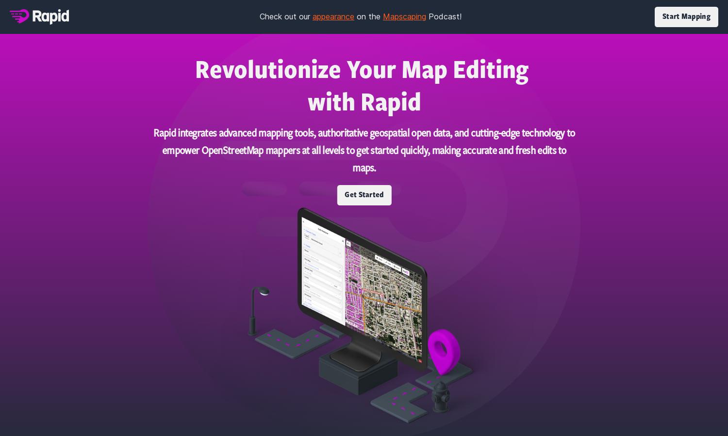
MapWith.ai revolutionizes mapping with an AI-driven Rapid Editor that simplifies identifying geographical features. Targeting humanitarian and community groups, this innovative platform utilizes satellite imagery to reveal unmapped areas. Users can effortlessly browse and edit maps, making it a powerful tool for global mapping projects.
MapWith.ai offers flexible pricing plans to suit a variety of users, including free access with essential features, and premium tiers providing advanced functionalities. Upgrading not only unlocks enhanced data analysis tools but also expedites the mapping process, adding significant value to users' projects.
MapWith.ai features a user-friendly interface designed for seamless navigation and efficient mapping tasks. Its layout is intuitive, making it easy for both novice and expert users to interact with the platform. Unique visual overlays enhance the mapping experience, ensuring clarity and accessibility for all users.
How MapWithAI works
Users begin by signing up for MapWith.ai and exploring its intuitive interface. The platform allows them to browse satellite imagery while AI algorithms highlight geographical features and areas needing mapping. Users can seamlessly edit and add data, benefiting from machine learning predictions that simplify the mapping process and enhance accuracy.
Key Features for MapWithAI
AI-driven mapping insights
MapWith.ai's AI-driven mapping insights enable users to see predicted geographical features instantly. This unique capability transforms raw satellite data into meaningful overlays, allowing for efficient mapping of unmapped areas. By leveraging AI, MapWith.ai significantly improves the mapping experience for humanitarian and community projects.
Intuitive user interface
The intuitive user interface of MapWith.ai enhances user experience by making mapping tasks straightforward. Users can easily navigate through features, access satellite imagery, and utilize AI analysis, making the platform accessible and efficient for anyone involved in mapping projects or data visualization.
Community-driven mapping projects
MapWith.ai supports community-driven mapping projects, allowing groups to collaborate and enhance geographical data together. This feature empowers humanitarian efforts by fostering cooperation among users while leveraging AI insights, leading to better coverage of unmapped areas and strengthened community engagement in mapping initiatives.
You may also like: