PicStork

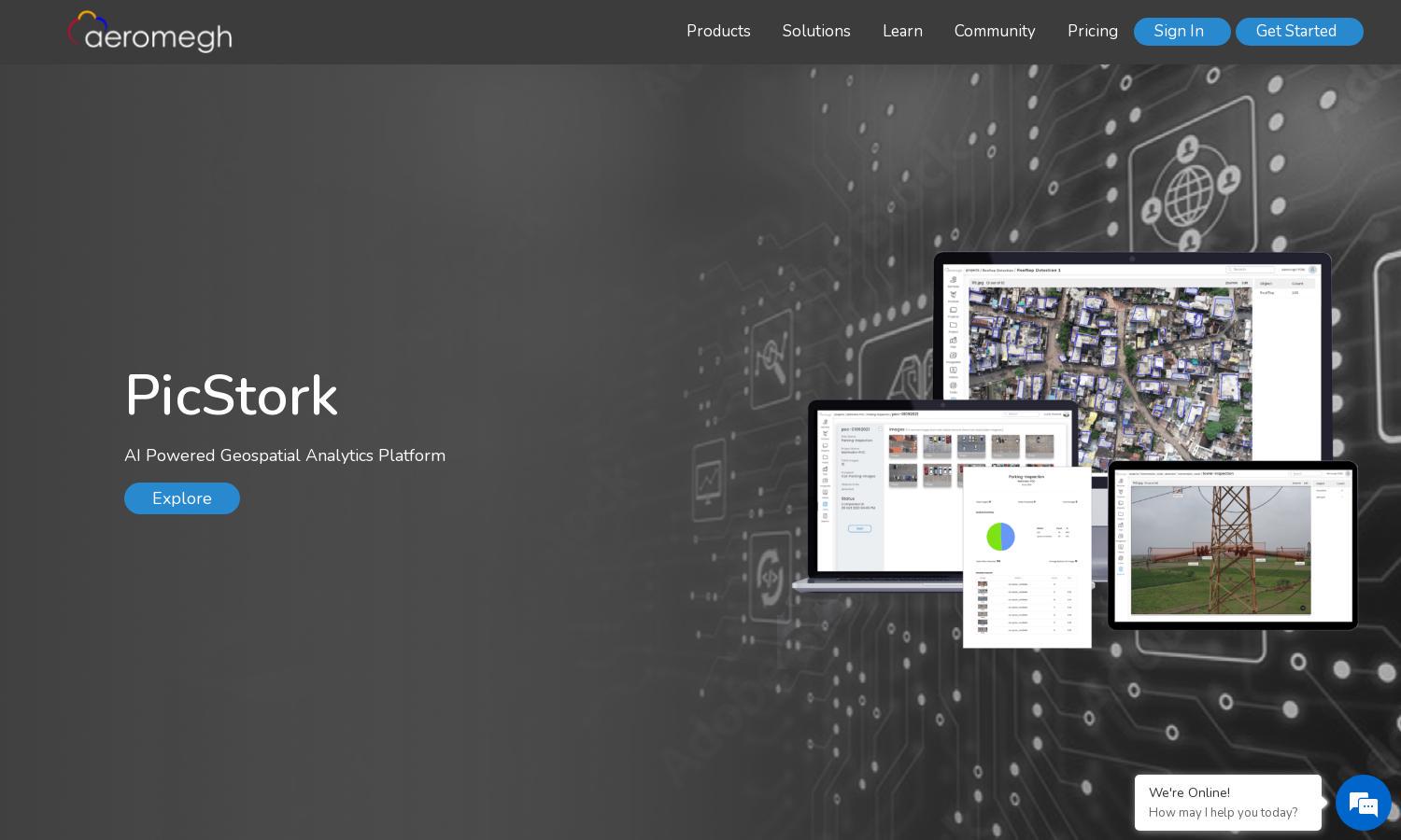
PicStork is an AI-powered platform for automated aerial image analysis and geospatial analytics.
August 13, 2024
Web App
PicStork Website

About PicStork

PicStork offers an AI-driven platform for seamless aerial image analytics, catering to professionals in geospatial industries. Users can easily upload datasets, train machine learning models, and create custom workflows, enhancing productivity and decision-making. PicStork’s innovative real-time analysis and secure cloud storage significantly improve operational efficiency.

PicStork features various subscription tiers, providing value-packed options for all users. Basic plans allow limited access to image analytics and model training, while premium tiers unlock advanced tools and priority support. Upgrading enhances user experience, with efficient processing and faster results for drone-captured images.

PicStork's user interface is designed for intuitive navigation and ease of use. The clean layout allows users to quickly find features such as dataset uploads, model training, and analysis results. Interactive dashboards make it simple to visualize data and generate reports, enhancing the overall user experience.

How PicStork works

To get started with PicStork, users sign up and upload their aerial imagery datasets. They can then utilize the platform's machine learning tools to train custom models and define workflows for analysis tasks. The system efficiently processes images in the cloud, providing instant results while users can track their analysis in real-time.

Key Features for PicStork

Real-Time Image Analysis

PicStork's real-time image analysis feature enables users to view and interact with results during drone flights. This unique capability allows for immediate insights and adjustments, enhancing operational effectiveness and decision-making on the ground, making PicStork invaluable for aerial imaging professionals.

Custom Model Training

PicStork offers custom model training that empowers users to create tailored machine learning models for object detection. This feature leverages optimized algorithms, providing speed and accuracy, ultimately streamlining the image analysis process and ensuring the highest precision results for users’ specific needs.

Seamless Workflow Creation

The seamless workflow creation feature in PicStork allows users to design personalized flight plans and analysis tasks effortlessly. This customizability enhances user experience, enabling efficient monitoring and analysis of aerial imagery, thus optimizing productivity while addressing diverse geospatial project requirements.

FAQs for PicStork

How does PicStork enhance aerial image analysis for users?

PicStork enhances aerial image analysis by automating the entire process from image capture to data processing. Users can upload datasets, train machine learning models, and perform real-time analysis, all on a secure platform. This reduces manual effort, speeds up results, and improves decision-making for geospatial professionals.

What features make PicStork suitable for model training?

PicStork is suitable for model training due to its robust tools allowing users to create custom machine learning models tailored to specific analysis needs. The platform's optimized algorithms ensure fast and efficient object detection, making it ideal for industries reliant on accurate aerial imagery interpretation.

How does PicStork facilitate user interaction with analysis results?

PicStork facilitates user interaction with analysis results through an intuitive dashboard that aggregates data in one place. Users can visualize statistics in real time and easily download or share reports, significantly enhancing user experience and streamlining communication with stakeholders regarding aerial image insights.

What unique features set PicStork apart from other image analytics platforms?

PicStork stands out with its real-time analysis and custom model training features. These capabilities allow users to visualize results during drone flights and tailor machine learning processes to their specific needs, providing exceptional value and efficiency compared to traditional image analytics platforms.

How does PicStork ensure data security for users?

PicStork ensures data security by securely transferring all information to the cloud, utilizing advanced encryption and access controls. This commitment to security allows users to focus on analysis without worrying about data breaches or loss, making it a reliable choice for sensitive aerial image data.

What are the key benefits of using PicStork for drone image analytics?

The key benefits of using PicStork for drone image analytics include automated workflows, real-time analysis, and customizable machine learning models. These features enhance accuracy and efficiency, allowing users to derive actionable insights quickly, thus streamlining their decision-making processes within various geospatial applications.

You may also like:

ChatGPT - QuantumRelated Website

ChatGPT - QuantumRelated

QuantumRelated is a platform for exploring quantum physics and computing concepts interactively.
ChatGPT - World War II Website

ChatGPT - World War II

ChatGPT provides a free and easy way to get answers and inspiration on various topics.
ChatGPT - Top 10 Website

ChatGPT - Top 10

ChatGPT is a conversational AI tool for writing, learning, and productivity assistance.
ChatGPT - Stock  & Equity Plans Advisor Website

ChatGPT - Stock & Equity Plans Advisor

ChatGPT provides advice on stock and equity plans to enhance employee compensation effectively.

Featured